


The Fingal team are providing training to the Physical Planning department of Lesotho on how to leverage Open Street Map and open data for the purposes of land use planning. This map is a geographic blog of our travels throughout Lesotho.
The Planning GPS strand of the ACtion Ireland Trust Project in Lesotho reached a landmark yesterday.

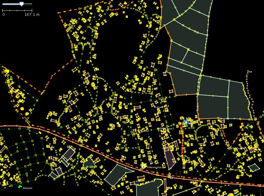
The area to be mapped today will be divided into three groups. Groups 1 - 4. The map below show's their boundaries. We will be digitizing from 13h00GMT today if you would like to join tweet us.
Every day in Lesotho brings us something different. As a last minute suggestion on Friday some of the Lesotho Planners said they were interested in a trip to Mohale Dam on the eastern border of the Maseru district.
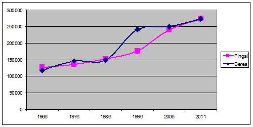
On Monday the Chief Planner of Lesotho asked if we would look at the issues caused by the sudden, and in some cases unplanned, building out of part of the Berea district call Ho Fuso. When the team started analysing the population data it seemed like Berea was very familiar. Here's why:
We set off from Dublin Airport on Saturday morning 8th of February and flew into London Heathrow, then we took a South African Airlines flight to Johannesburg (O.R. Tambo) and then almost 24 hours later we arrived at Moshoeshoe airport in Lesotho. We were greeted at the airport by our colleagues from the Fingal based charity group, Action Ireland Trust (AIT). We got a great welcome from the AIT guys and they swept us all off to our hotel where we will base ourselves for the next two weeks.